SPEAKERS

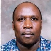
Joseph Matere
Predictive Livestock Early Warning (PLEWs)
Food and Agriculture Office of the United Nations (FAO)
Joseph, a Kenyan national and Cartographer by profession has a degree in Geography from the University of Lagos, Nigeria, a professional master’s degree in Cartography from the International institute for Aerospace Survey and Earth Sciences (ITC), Netherlands. Joseph has over 27 years’ experience in Geographic Information System and Remote Sensing having worked with the Kenya Government (5 years), Dallas Mapping Company (Mapsco 1 year), the International Livestock Research Institute (5years), Asareca Animal Research Network (AARNET, 5 year), Unicef (1 year) and Food and Agriculture Organization (10 years).
My experience in Geographic Information System and Remote Sensing at Government (Surveying and Mapping Department Kenya Polytechnic 5 years) research (International Livestock Research Institute 5 years, Asareca Animal Research Network 5 years) and development environment (UNICEF 1 year, Food and Agriculture Organisation 9 years,).
Joseph is currently the Geospatial information officer for FAO Representation where he supports compilation of risk maps on Ebola and other florivures and Mer Corona project activities using advanced analytical Geospatial tools.
Joseph is currently managing the innovative Predictive Livestock Early Warning System (PLEWs) a drought risk management tool that holds great potential in enhancing preparedness through a six months forage condition prediction.
Key technical competencies include:
- Proven expertise in development of consolidated repository of baseline information;
- Proven experience and expertise in G.I.S, G.P.S. and remote sensing (object oriented image classification) for livestock applications.
- Proven team building/mentoring skills in developing innovative cutting edge platforms for scalable decision support (Multi criteria evaluation maps, livestock diseases risk maps, mobile based surveillance platforms).
- Practical competence in spatial database management and analysis using spreadsheets, SQL and DBS software
- Expertise in Remote Sensing and associated analysis using ERDAS Imagine and IDRISI, PCI-Geomatica and ENVI Image Processing software and object oriented image analysis.
- Developed effective models for drought and flood mitigation targeting poor communities and the manager for the innovative Predictive Livestock Early Warning System (PLEWs).
- Effective team-player in capacity building for livestock disease based projects implementation and management.